Types of Roads in India
With India’s continuous push for infrastructure development, road connectivity and surface transport in India are at their highest levels. A road network of over 63.73 lakh kilometres has already made India 2nd in the world, narrowly behind the US. So, what are the different types of roads in India that make up this giant road infrastructure? Let’s find out.
Roads are necessary for the movement of commodities and for transportation. The much-needed connectivity between states, cities, towns, and villages is provided by various types of highways. It has been essential to the social, cultural, and economic advancement of our country.
The location, utility, and availability of materials determine the kind of road that can be found in an area. There are seven different types of roads in India, as listed below, each with a specific function.
- National Highways
- Expressways
- State Highways
- District Roads
- Village Roads
- Border Roads
- International Highways
National Highways
India’s national highways are at-grade roads that link important cities across the nation like arteries. The letter NH is used to identify national highways, followed by the highway number. The width of the carriageway determines the further classification of Indian national highways. India has the following kinds of national highways:
- Single-lane highway
- Double-lane highway
- Four-lane highway
- Six-lane highway
- Eight-lane highway
The organizations in charge of building, maintaining, and overseeing India’s national highway system are the National Highways Authority of India (NHAI) and the National Highways and Infrastructure Development Corporation Limited (NHIDCL).
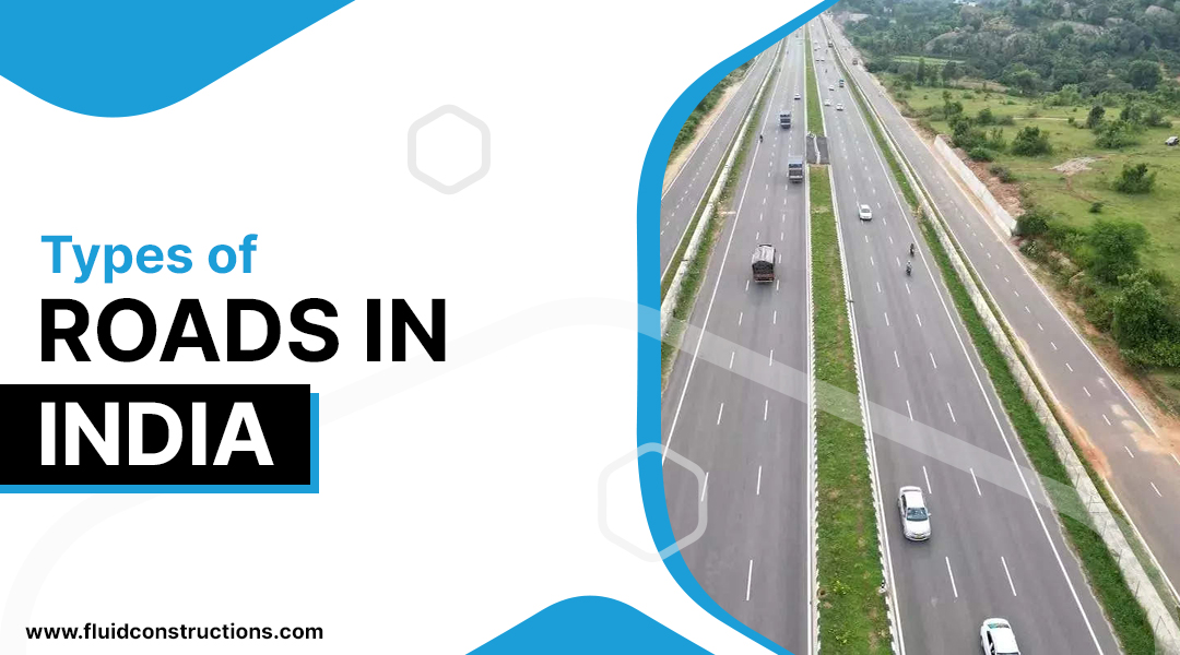
Expressways
As the name suggests, the expressways are meant for speed driving. These are
the highest type of highway in India. With six to eight lanes of restricted access roads, expressways are the best quality highways. comprising feature elements such as grade separation, elevated parts, lane dividers, and access ramps.
While national highways are limited access highways, expressways are controlled-access highways. This means that although national highways have several entry and exit points, expressways only have certain locations from which you can enter or exit.
India’s expressways are outfitted with a number of sophisticated and advanced amenities, such as a Video Incident Detection System (VIDS) and a Highway Traffic Management System (HTMS). They are also environmentally friendly for the future.
The total length of expressways in India stretches 5,342 km (3,319 mi) in total as of July 2023; another 8,603 km (5,346 mi) are being built. The speed limit on the expressways for four-wheelers is 120 km/h, and for two-wheelers is 80 km/h.
The Delhi-Mumbai expressway will be India’s longest motorway once construction is completed, expected by the end of 2026.
The partially opened Delhi-Mumbai expressway (Phase-III) is currently the longest motorway in India at 692 km (430 mi). The Delhi-Dasna (UP border) segment of the Delhi-Meerut Motorway, which has 14 lanes and was completed in 2021, is currently the widest motorway in India.
.
State Highways
State highways are at-grade roads that connect the big cities within a state. They can also have connections with the state highways of adjacent states or national highways. State highways are identified by the letter SH, which is placed before the state code and after the highway number.
The authority and discretion to construct state highways rest with the state governments. State public works departments are responsible for developing the majority of state roadways.
The states of Maharashtra, Karnataka, Gujarat, Rajasthan, and Tamil Nadu have the highest numbers of state highways. Individual statistics show Maharashtra has the highest percentage of state highways (22.14%), followed by Tamil Nadu (6.67%), Karnataka (11.11%), Gujarat (9.76%), Rajasthan (8.62%), and Maharashtra (11.11%).The administrations of each state are responsible for the creation and upkeep of these highways.
District Roads
In India, a state is divided by many districts. The district roads are the major roads within a district and often connect with the roads in adjacent districts.
Local residents use these roadways to get to places like workplaces, marketplaces, hospitals, and schools. Additionally, these roads provide access to nearby state and national highways.
District roads can be further divided into main roads and minor roads based on their location and purposes. A district’s main roads often connect with the different places in its bordering districts. Whereas, a district’s secondary roads are generally limited to connecting the areas within.
Some district roads also connect rural areas or villages for the purpose of facilitating the transport of goods and raw materials needed by residents in remote areas. These roads are extremely crucial, as they enable farmers in rural villages to deliver their produce to APMCs or markets in nearby localities.
Rural Roads
Rural roads make up a significant percentage of the nation’s road network. Around 73% of all roads in the nation are rural roads, and 31% of the total length of rural roads are unsurfaced.
The Indian government started the Pradhan Mantri Gramme Sadak Yojana (Prime Minister’s Rural Roads Scheme) in December 2000 to build these rural roads and connect remote rural communities. According to the plan, the village panchayats will build and maintain these roads. The government has made an effort to oversee the plan directly as a local social spending initiative in some regions of India.
Rural roads are generally made of bitumen or locally available materials. Following are the common types of rural roads:
- WBM roads
- Kankar roads
- Murrum roads
- Earthen roads
- Border Roads
The roads built along the country’s northern and northeastern borders are known as border roads. The Border Roads Organisation (BRO), established by the Indian government in 1960, is responsible for building and maintaining these roads. BRO is recognized as a symbol of national integration, and nation-building, and as an essential part of preserving national security.
International Highways:
These are the nation’s highways that connect India with its neighboring countries. There are several of them, such as
- India – Myanmar – Thailand trilateral highway (IMT highway)
- AH-42 – Connects India with China through the Himalayas
- AH-43 – Connects India with Sri Lanka
- AH-45 – Under planning to connect India with Indonesia in the east and Qatar in the West.
- AH-48 – Connects India with Bhutan and Bangladesh.
Frequently asked questions
Which Indian state shares the largest highway network?
A: Maharashtra has the maximum number of state highways. 33.14% of the total highways in the country are found in Maharashtra.
Which state has the best roads in india?
A: Gujarat has the best road infrastructure in India.
Which is the longest road in india?
A: NH 44, which runs over 4112 km. connecting Srinagar with Kanyakumari, is the longest road in India.

